Réunion is a member of the Mascarene islands, together with Mauritius and Rodrigues. The island is situated in the Indian Ocean, 800 km east from Madagascar and slightly north to the Tropic of Capricorn. According to the estimations the volcanic island is 2-3 million-year-old, so it is a relatively young one. Its area is only 2511 km2 but it has a very diverse relief and climate. Climatologists distinguish approximately 200 types of microclimates on Réunion! The western coast is the leeward coast with a milder climate, while the eastern, windward coast and the central mountain regions receive far more precipitation. A yearly rainfall of 6,000-12,000 mm is typical, and there were some years with 18,000 mm of total precipitation. The
Guinness Record of the maximum amount of precipitation within 24 hours was registered in Cilaos, Réunion: the record is 1,870 mm!!! (This amount of rain falls within three years in Hungary.)
In July, there is the mild Austral winter with 20-27 C temperatures and not so much rain, so it is a perfect destination for those who want to escape from the hot European summer.
 |
| The location of Réunion in the Indian-ocean. |
|
|
The first permanent settlers of the island arrived from Madagascar in the early 1500s. The first Europeans were the Portuguese who arrived in 1507. The French started to rule the island from the early 1600s. Colonisation was intensified from 1665, when the French East India Company sent settlers to Réunion. The wealth and economical development of the island was mainly due to two flagship products: the Bourbon vanilla and the sugar cane. Today, Réunion is an overseas department of France. For a European traveler it is very casual: the currency is Euro, the whole island is absolutely safe and can be best explored by car.
 |
| The Bourbon vanilla is one of the flagship delicacy products of the island. Vanilla is an orchid species native in Mexico, which was introduced to Réunion in the 19th century. First, its cultivation was very challenging, as there were no proper pollinators in the island. The invention of Edmond Albius, a 12-year-old slave was the solution to the problem: he figured out how to pollinate vanilla by hand. This invention gave the wealth for the French Bourbon vanilla barons. The name Bourbon is included in the scientific name of many endemic plant and animal species, in the form of 'borbonicus'. Nowadays there is a trend for growing vanilla inside the rainforests - this is a very good initiative as this way the forest habitats can be maintained. |
 |
| The other world-class product of the island is the sugarcane, and the famous rum made of it. Unfortunately sugar cane plantations occupy large areas in the lowlands and mid-elevated places; thus, many of the original habitats disappeared there. However, there are still more natural habitats here than in Mauritius. |
 |
| The local pineapple is great - it is very sweet and soft. |
 |
| Saint Pierre has one of the oldest harbour in the island. This small city has a great atmosphere, full with life. |
 |
| The island has multicultural influences which can be sensed also in its great cuisine: Creol,
French, Asian and African flavours inspire the great dishes. Streetfood is really delicious, here you can see a large selection of samosas. |
Réunion has two major volcanic massifs: the extinct volcano, Piton
de Neiges and the active volcano, Piton de Fournaise. The last eruption of Piton de Neiges ('Snowy Peak') occurred approximately 10,000 years ago; today, this is the highest peak on the island and also on the Indian Ocean, with its height of 3071 m. Very rarely it occurs that there is snow on the 'Snowy Peak' - a few times in the recent decades the cold winds from Antarctica brought snow here. The nesting colonies of two endemic petrel species can be found only on the high-altitude rocks of the Piton de
Neiges.
 |
| The spectacular extinct volcano, Piton des Neiges. |
 |
| Cilaos
settlement is situated inside a caldera. There is only one road which goes there - it has 400 hairpin curves. From Cilaos there is a spectacular view on the largest extinct volcanoes of the island. |
The Piton de Fournaise, is one of the most active volcano in the world. This is a 2632 m tall shield volcano. In some years there are two or three eruptions (you can see a video
here). Its age is estimated as 530,000 years. The south-eastern third of the island has been shaped by this spectacular volcano.
 |
| The road to the Volcano leads through a martian landscape called the Plaine de las Sables. |
 |
| The deepest crater (called Commerson crater), is the result of an explosive eruption. It is approximately 300m deep and 250m wide. |
 |
| Martian landscape of the Plaine de las Sables. |
 |
| For reaching the summit of the Piton de Fournaise, first we have to descend to the caldera and climb up the 180m high staircase after the trip. :) |
 |
| Rainbow in the caldera. |
 |
| One of the most spectacular volcanic formation is the Formica Leo. It got its name from its special shape, which resembles to the trap of the ant-lion. The last eruption of this small crater occurred in the 1700s. |
 |
| Old lava flow in the foreground, young lava flow in the background. |
 |
| There are very special lava formations in the caldera. |
|
 |
| Pahoahoe type lava surface, which is characterised by fine wrinkles and smooth surface. |
 |
| The fog comes every afternoon, even on the sunniest day. |
 |
| Mountains above the clouds. |
During the
Island Biology Conference, we had a mid-conference excursion to the lava flows of the east coast to explore the primary succession of these special surfaces. There is a couple of kilometres long Lava Route on the east coast, where we could observe a nice chronosequence of the lava flows of the largest recent eruptions. The eruption in 2007 was among the largests, and the lava flew into the ocean. Generally the flow of the lava takes 15-20 years. The first colonizers are lichens and pioneer ferns. There are some pioneer woody species, such as
Agarista salicifolia which can colonise the 10-year-old lava surface. Unfortunately there are several alien woody species, especially the
Casuarina trees that can quickly colonise the lava.
The special 'lava-vegetation' is very sensitive to fire, so there is a need for fire suppression in these habitats.
 |
| The first colonizers of the lava are lichens and ferns, such as Nephrolepis abrupta. |
 |
| A few years later, vegetation cover increases and there are several woody species that can establish. At the left background you can see a dense patch of the common ironwood (Casuarina equisetifolia) which is among the most competitive alien species on lava flows. |
 |
| After the largest eruptions, the lava flows 20 km to the Indian-ocean. |
 |
| The eruption in 1986 increased the area of Réunion with 25 hectares. |
|
 |
| Like a miracle: the Notre Dame des Laves church in Sainte Rose remained intact during a large lava flow. |
| | |
The paper of
Strasberg et al. (2005) gives a comprehensive and interesting overview on the original and current habitats of Réunion island. After the conference, we had the possibility to visit and explore most of the habitat types of the island. We give some impressions on the habitats starting in the coast towards the high mountains. In Réunion, like in many other places the coastal and lowland areas have always been subjected to the largest human pressure (agriculture, urbanisation, infrastructural development); therefore, the original habitats of these lowland areas (e.g. savanna, lowland rainforest, inland wetlands) suffered the highest rate of habitat conversion, degradation and invasion of alien species. In the high mountains, there are several undisturbed, natural habitats. However, the population growth, increasing tourism and climatic changes might threaten these habitats in the future.
 |
| The coastal lowland areas were originally covered by grassy savanna with scattered palm trees - according to the descriptions of travelers in the 1500s. |
 |
| The savanna in Réunion in the dry austral winter. |
 |
| The border of the burnt and unburnt savanna. |
 |
| Unfortunately, the few remaining stands of the savanna suffered severe degradation due to the encroachment of woody species. Goat pasturing might be a solution that could still help in restoring the original state. |
 |
| The enemy of the savanna, the white leadtree (Leucaena leucocephala) is a mimosoid species originating from Mexico. It is included in the IUCN list of the 100 most dangerous global invasive species. |
 |
| The southern coast receives large waves and Antarctic winds. |
 |
| In the very windy and cool southern coast the 'vacoa', i.e. the screwpine (Pandanus utilis) groves are typical. |
 |
| The 'utilis' is a very adequate species name: the fruit is a delicacy after cooking, the leaves are perfect material for making baskets and other handcraft items (most of these in the local markets are made from vacoa), and they also use the leaves as roofing material. |
 |
| We found this panther chameleon (Furcifer pardalis) near the southern coast. |
 |
| This species is usually much more colorful and decorative. But if chameleons feel cold, they often get black in order to absorb a larger amount of sunlight. |
 |
| From 2011 there were many serious shark attacks in Réunion. That is why it is not possible to swim in many parts of the coastline except for a few protected lagoons. |
 |
| The hawksbill turtle (Eretmochelys imbricata) is the most widespread sea turtle here. |
 |
| Mudskipper on the coastal rocks. |
 |
| The beach morning glory (Ipomoea pes-caprae) is the most typical plant forming dense mat-systems on the sandy coasts. |
 |
| Due to the constantly high moisture there are always rainbows everywhere :) |
 |
| Unfortunately most of the lowland rain forests were converted to sugar cane plantations. During the mid-conference excursion, we went to the wonderful Mare Longue lowland rainforest - where we had a huge rainfall, so this is our only picture from that site :) On the picture, our group is listening to an interesting story about the role of giant turtles in seed dispersal. Several tree species require turtles as seed dispersers - they digest the fruits for a long time, which is important for the induction of germination and can disperse the seeds over long distances. To support this important function, there are several turtle rewilding projects in Réunion. |
 |
| The most lush tropical vegetation can be found on the wet eastern side of the island. |
 |
| Mountain forests near Cilaos. |
 |
| Beard lichen. |
 |
| Endemic mountain tamarind trees (Acacia heterophylla). |
 |
| Luxuriant tropical vegetation with fern trees. |
 |
| The trail in the Bebour-Belouve cloud forest. |
 |
| That is why it is called cloud forest :) |
 |
| The South-African calla lily (Zantedeschia aethiopica) is typical in the mountain rain forests. |
 |
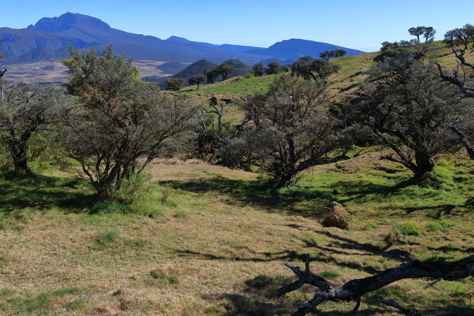
| Cattle pasture in the high mountains, near Nez de Beouf. |
 |
| Two endemic shrubs: the yellow one is Erica reunionensis and the grey one is Stoebe passerinoides. |
 |
| The colonies of the village weavers (Ploceus cucullatus) are widespread in urban and rural areas. |
 |
| Tropicbirds (Phaethon lepturus) are beautiful and extremely annoying birds, as they are constantly mowing and it is hard to take photos of them :) |
 |
| Moorhen (Gallinula chloropus) on water lettuce (Pistia stratiotes). Moorhens build their nests on the aquatic vegetation. Wetlands are dominated by alien plants. |
Like in many islands, rabbits and rats are the most dangerous invasive animal species. But unfortunately there are many other invasive and alien animal species.
 |
| This African snail species was introduced as a promising protein source for animal husbandry - unfortunately, it turned to be not so useful but became widespread throughout the island. |
 |
| The red-whiskered bulbul (Pycnonotus jocosus) is a widespread invasive species. |
 |
| Goodbye sunset over the Indian-ocean. |
 |
| The harbour of Saint Gilles. |